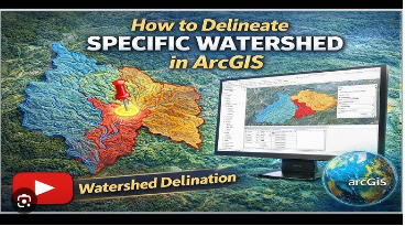
 Remote Sensing & Gis: Watershed Delineation With Arcgis
Published 3/2026
Created by Padala Raja Shekar
MP4 | Video: h264, 1280X720 | Audio: AAC, 44.1 KHz, 2 Ch
Level: All Levels | Genre: eLearning | Language: English | Duration: 15 Lectures ( 2h 24m ) | Size: 1.41 GB
Remote Sensing and GIS: Step-by-Step Watershed Delineation Using ArcGIS for BeginnersWhat you'll learn✓ Understand the basic concepts of hydrology and watershed systems including the hydrological cycle, infiltration, runoff, and groundwater.
✓ Learn how to download and prepare DEM data using USGS EarthExplorer for watershed analysis.
✓ Perform watershed delineation step-by-step using ArcGIS tools such as Fill, Flow Direction, Flow Accumulation, Snap Pour Point, and Watershed.
✓ Create and process watershed boundaries including converting raster to polygon, clipping layers, and calculating watershed area.
Requirements● Basic computer knowledge and ability to install and use software.
● Interest in Remote Sensing, GIS, or hydrology concepts.
● No prior GIS experience is required - this course is designed for complete beginners.
● A stable internet connection to download DEM data.
DescriptionThis course, "Remote Sensing and GIS in Watershed Management: Step-by-Step Watershed Delineation Using ArcGIS for Beginners," is designed to provide a clear and practical understanding of how Remote Sensing and Geographic Information Systems (GIS) are used in watershed studies. It is especially suitable for beginners, including students, researchers, and professionals in civil engineering, environmental science, and water resources management who want to learn GIS-based watershed analysis from the basics.
The course begins with an introduction to fundamental hydrology concepts such as the hydrological cycle, precipitation, infiltration, evaporation, transpiration, runoff, and groundwater flow. Understanding these concepts helps learners recognize how water moves within a watershed and why watershed management is important for sustainable water resources.
Participants will then learn how to obtain and prepare Digital Elevation Model (DEM) data, which is the most important dataset for watershed delineation. The course explains how elevation data influences water flow and drainage patterns. Step-by-step tutorials demonstrate how to use essential ArcGIS tools such as Fill, Flow Direction, Flow Accumulation, Stream Definition, and Watershed tools.
Through practical, hands-on exercises, learners will understand how to extract drainage networks, delineate watershed boundaries, and analyze terrain for hydrological studies. The course focuses on a simple and easy-to-follow workflow so that even beginners with no prior GIS experience can understand the process.
By the end of the course, participants will be able to independently perform watershed delineation and basic hydrological analysis using ArcGIS. These skills are highly valuable for watershed management, flood analysis, environmental planning, and sustainable water resource development.
Who this course is for■ Undergraduate, postgraduate (Master's), and PhD students interested in watershed analysis using ArcGIS and Geographic Information Systems.
■ Anyone who wants to learn step-by-step watershed delineation using DEM data.
■ Professionals in water resources, environmental engineering, or planning who want to perform watershed delineation using ArcGIS.
https://rapidgator.net/file/e5ec189895e67bda6d7ceb7952c608d3/Remote_Sensing_&_GIS_Watershed_Delineation_with_ArcGIS.part1.rar.html
https://rapidgator.net/file/0af75b24ed65ef4c60e8898d5eef9d4e/Remote_Sensing_&_GIS_Watershed_Delineation_with_ArcGIS.part2.rar.html
https://nitroflare.com/view/0F1FD2B115C7C91/Remote_Sensing_%26amp%3B_GIS_Watershed_Delineation_with_ArcGIS.part1.rar
https://nitroflare.com/view/F935F86BB71058D/Remote_Sensing_%26amp%3B_GIS_Watershed_Delineation_with_ArcGIS.part2.rar

 Cantinho Satkeys
