x64 | Languages: Multilingual | File Size: 118 MB
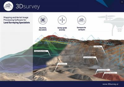
3Dsurvey is a software solution for land surveying data processing. Take a photo with any standard digital camera, import images into 3Dsurvey and produce your own orthophoto maps, digital surface models and calculate volumes faster and more easily. Data is processed automatically based on matching algorithms. Use our smart tools to be even more efficient.
Works with any drone and any camera
3Dsurvey software is designed to work with any digital camera, DSLR or GoPro. Use any UAV to capture aerial terrain images or check our PACKAGE SOLUTIONS.
Land surveying tool accuracy
Get the most accurate end results in a fast and elegant manner. Our team of experienced land surveyors and devoted computer vision specialists understands first-hand the importance of your end result accuracy.
No *.log from flight path needed
No need for downloading the flight point file from your drone or paying expensive systems to geo tag your aerial images. Simply import images from your camera and start processing.
Developed based on real projects
Being fast and efficient at land surveying projects every day is the foundation of 3Dsurvey. Our software is developed based on experience from more than 300 end customer drone projects! Check our SHOWCASES.
Cut your fieldwork time by up to 9x and perform like a team twice your size.
Automate your aerial site mapping and mission planning and save up to 90% of your time spent on the field. Gather data with cm-grade precision and eliminate the need for repeat site visits. Survey with ease, comfort and absolute safety in even the roughest of terrains.
- Compatible With Any Drone, Any Camera
- Cm-grade Precision
- Real-time Data Telemetry
- FREE Aerial Mission Planning Mobile App
Transform your data into accurate digital maps, 3D models and interactive measurements
Import raw data from any compatible source and recreate natural environments in digital form. Generate and process precise point clouds with automated classification. Produce high-res orthophotos, realistic surface models, contour maps, spatial measurements, and more fully customizable survey-grade deliverables.
- Accurate, Survey-grade Results
- Powerful Processing Engine
- Intuitive, User-friendly Experience
- Highly Compatible, AutoCAD-ready solution
Collaborate with experts across all industries
View, share and explore projects from 3Dsurvey and any third-party sources with 3Dsurvey Viewer. Empower your team and clients to work directly with highly representative 2D and 3D data. Perform simple digital surveying tasks in real-time with uncompromised visual quality.
- Easy Team Collaboration
- Simple, Intuitive and User-friendly Data Sharing
- Supports Any Third-party Sources, Point Clouds and 3D Models
- FREE Project Sharing App
Download link:
Só visivel para registados e com resposta ao tópico.Only visible to registered and with a reply to the topic.Links are Interchangeable - No Password - Single Extraction

